
Design Utility Locates for Utility Owners
At Know Before You Dig Locates, we help utility owners, property managers, and private infrastructure owners identify, verify, and map their buried utility lines on private property. Whether you manage gas, water, power, sewer, or communications infrastructure, we deliver design-grade underground utility data (QL-B) to support asset management, internal mapping, and future planning.

Missing or Incomplete As-Builts? We Can Help.
Many utility owners do not have accurate or complete as-built records, especially for older or privately owned infrastructure. We locate and document buried utility lines to help you:
-
Update internal records or GIS systems
-
Reduce risk during future ground disturbance
-
Plan upgrades, replacements, or expansions
-
Support engineers and contractors with reliable design input

.jpg)
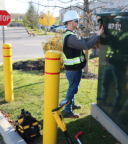
Why Utility Owners Work With Us
-
We use GPR, electromagnetic locating, and field correlation to identify and verify undocumented or poorly recorded buried utility lines
-
We support privately owned infrastructure on private property, including lines beyond the point of demarcation
-
Our deliverables include photo documentation, scope boundaries, Quality Level labeling, and CAD compatible data
-
If records are missing or incomplete, we help rebuild an accurate underground picture you can rely on
-
Need to transfer data to an engineer, surveyor, or contractor? We format outputs to match their workflow
What You Get
-
Utility Record Research and Compilation (QL-D)
We review available drawings and records, when they exist, and identify gaps in underground information that may affect asset management or future work.
-
Surface Feature Identification and Correlation (QL‑C)
Visible access points such as valve boxes, hydrants, control pedestals, manholes, and vaults are identified and correlated to help interpret underground routing.
-
Field-Based Utility Line Locating (QL‑B)
Using electromagnetic locating, sonde tracing, and ground penetrating radar, we identify and document buried utility lines on private property to support mapping, planning, and coordination.
-
Field Markings and Photo Documentation
All identified lines are clearly marked in the field and photographed. Documentation is provided to support internal records, coordination, and future reference.
-
Coordination Support
Deliverables may include a PDF report, photo log, and optional CAD or GIS files, depending on your internal needs and workflows.
⚠️ IMPORTANT NOTE
We do not produce stamped engineering drawings or Subsurface Utility Engineering deliverables. Our services support asset owners by providing field-verified underground information for internal mapping, planning, and coordination with engineers or SUE firms when required.
Know What You Own. Fill in the Gaps. Plan Ahead.
Accurate underground information is the foundation of safe operations, informed planning, and responsible asset management. We help you understand what exists below ground so future work can be planned with confidence instead of assumptions.
CONTACT US
Or call us at 1-800-905-8204