
Design Utility Locates for Municipalities & Public Works
At Know Before You Dig Locates, we support municipalities, counties, and public works departments by providing accurate, field verified underground infrastructure data on public and private property. Whether you are planning a capital works project, updating GIS records, or locating legacy infrastructure, we deliver design grade underground utility data at the QL B level to support safe planning, infrastructure renewal, and informed decision making.
Our work focuses on identifying and documenting buried facility alignments, access points, and data gaps that often exist in older systems or inherited assets.

Build a Better Underground Record
Public infrastructure teams are often responsible for systems they did not install and, in many cases, cannot fully locate. Records may be incomplete, outdated, or missing entirely. We help close those gaps by locating and documenting buried infrastructure so you can plan with confidence.
Our work helps you:
-
Locate undocumented, abandoned, or legacy buried lines
-
Add missing or uncertain segments to your GIS or internal records
-
Support engineering consultants and capital works projects with QL B data
-
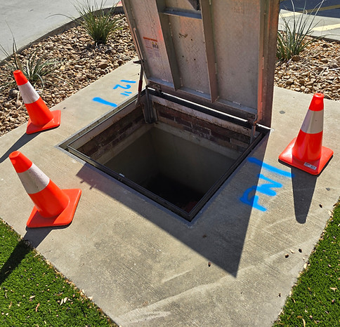
Verify surface structures such as manholes, catch basins, vaults, and chambers
-
Reduce risk during maintenance, upgrades, and future ground disturbance
We assist with mapping buried infrastructure in roadways, parks, easements, facility yards, cul de sacs, schools, fire halls, community buildings, and similar municipal environments.

Why Municipalities Work With Us
-
We deliver QL-D through QL-B underground utility data aligned with ASCE 38-22 quality levels
-
We support internal municipal teams, contracted surveyors, and engineering consultants with field-verified data
-
We locate buried lines on public and private property, including beyond the meter and outside standard record limits
-
Our work supports capital projects, asset management, and long-term infrastructure planning
-
Deliverables include clear field markings, photo documentation, QL labels, and CAD-ready outputs
-
GIS-compatible files can be provided to integrate directly into municipal mapping systems
What You Get
-
Utility Record Research and Compilation (QL-D)
We review available drawings and records, when they exist, and identify gaps in underground information that may affect asset management or future work.
-
Surface Feature Identification and Correlation (QL‑C)
Visible access points such as valve boxes, hydrants, control pedestals, manholes, and vaults are identified and correlated to help interpret underground routing.
-
Field-Based Utility Line Locating (QL‑B)
Using electromagnetic locating, sonde tracing, and ground penetrating radar, we identify and document buried utility lines on private property to support mapping, planning, and coordination.
-
Field Markings and Photo Documentation
All identified lines are clearly marked in the field and photographed. Documentation is provided to support internal records, coordination, and future reference.
-
Coordination Support
Deliverables may include a PDF report, photo log, and optional CAD or GIS files, depending on your internal needs and workflows.
⚠️ IMPORTANT NOTE
We do not produce stamped engineering drawings or Subsurface Utility Engineering deliverables. Our services support asset owners by providing field-verified underground information for internal mapping, planning, and coordination with engineers or SUE firms when required.
Support for Planning, Maintenance, and Capital Projects
Whether you are planning upgrades, responding to failures, or preparing for capital works, having accurate underground information reduces risk and improves outcomes. We help municipalities and public works teams make informed decisions by filling gaps in records and clarifying underground conditions before work begins.
When projects advance to detailed engineering or construction, we coordinate with your consultants to ensure a smooth handoff of verified field data.
CONTACT US
Or call us at 1-800-905-8204